Mapping the Future of Farming: The First Global 10m Resolution Agricultural Field Boundary Map
Discover the groundbreaking global agricultural field boundary map at 10m resolution. Learn how AI and satellite imagery are transforming crop monitoring, food security, and sustainable agriculture worldwide.

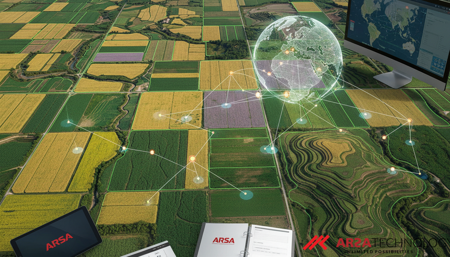
Revolutionizing Agriculture: The Need for Field-Level Data
For centuries, the agricultural field has been the fundamental unit of farming – the space where crops are planted, managed, and harvested. Yet, surprisingly, most global remote sensing products designed to monitor agriculture operate at a much cruder level: the pixel. This means satellite imagery might tell us a region is "cropland" or show general vegetation health, but it often fails to delineate the individual fields that define agricultural operations. This disconnect between how we observe agriculture from space and how it's organized on the ground creates significant challenges for precise monitoring, effective policy-making, and understanding global food systems.
The absence of a consistent, openly available global map of agricultural field boundaries has been a major gap. While some high-quality field data exists, it’s typically limited to specific regions, often derived from local government parcel registries or machine learning models tailored for individual countries. These regional solutions lack global consistency and often come with access restrictions or significant costs. The result is an incomplete picture of global food production, land use, and farm structure, hindering efforts to address critical issues like food security and sustainable development.
Introducing the First Global 10m Resolution Field Boundary Map
A significant breakthrough now addresses this long-standing challenge. Researchers have unveiled the first global agricultural field boundary dataset at an impressive 10-meter resolution. This monumental undertaking involved creating 3.17 billion remote-sensing field polygons across 241 countries and territories for the years 2024 and 2025 (1.62 billion in 2024 and 1.55 billion in 2025). This map finally provides a globally consistent, field-level unit of analysis, transforming how we can approach crop monitoring, food security, and a wide array of downstream agricultural sciences.
This map is not merely a collection of lines; it represents a foundational shift in understanding agricultural landscapes. Unlike previous efforts, which were regional or required extensive manual labor, this initiative offers a comprehensive, wall-to-wall solution. It promises to empower governments, enterprises, and researchers with unprecedented precision in analyzing agricultural activity, revealing previously unseen dynamics of global land use, and supporting more informed decision-making across the entire agricultural value chain.
How AI Transforms Satellite Data into Actionable Insights
The creation of this global map was made possible by leveraging advanced artificial intelligence and publicly available satellite imagery. The process involved training a sophisticated AI model, specifically a U-Net semantic segmentation model with an EfficientNet-B7 encoder (known as the PRUE model), on the Fields of The World (FTW) benchmark dataset. This dataset comprises 1.6 million field polygons from 24 countries, paired with bi-temporal (two points in time) Sentinel-2 satellite imagery. Semantic segmentation, in simple terms, is an AI technique that classifies each pixel in an image, effectively drawing precise outlines around objects of interest – in this case, agricultural fields.
The AI model was applied to cloud-free global mosaics generated from Sentinel-2 satellite imagery. Sentinel-2, a constellation operated by the European Space Agency, offers free, global, 10-meter resolution multispectral imagery with a frequent 5-day revisit time, making it an ideal data source for automated, repeatable field boundary extraction. The model processes these images to identify three classes: field interior, field boundary, and background. This automated approach bypasses the slow and expensive manual digitization methods that previously made global-scale mapping impractical. Companies like ARSA Technology, with expertise in AI Video Analytics, can apply similar robust AI models to derive critical insights from diverse visual data streams, from industrial sites to vast agricultural expanses.
Unlocking Critical Agricultural Applications
The availability of a global, 10-meter resolution field boundary map unlocks a multitude of practical applications and drives significant business value across the agricultural sector and beyond. For instance, more precise field boundaries enable:
- Crop Type Mapping & Yield Estimation: Accurate field outlines allow for better identification of specific crop types and more precise predictions of yield at a granular level, improving global food supply forecasting.
- Pest and Disease Surveillance: Early detection and containment of outbreaks become more feasible when monitoring can be localized to individual fields.
- Resource Use Tracking: Farmers and regulators can more effectively track water consumption, fertilizer application, and pesticide use, leading to more sustainable practices and reduced environmental impact.
- Measurement, Reporting, and Verification (MRV) for Climate Programs: This data is crucial for validating conservation efforts, carbon sequestration initiatives, and other climate-smart agriculture programs, essential for compliance and carbon markets.
- National Statistics and Policy: Governments can use this baseline data for improved agricultural survey design, resource allocation, and policy development.
- Socioeconomic Dynamics: Multi-year boundary maps offer insights into farm consolidation or fragmentation, revealing important socioeconomic trends impacting rural communities.
- Regulatory Compliance: Emerging regulations, such as the European Union Deforestation Regulation, increasingly demand spatially explicit evidence of agricultural land use. A consistent global map provides this evidence, reducing compliance risks for enterprises.
The insights derived from such detailed geospatial intelligence can significantly reduce operational costs, enhance security, and create new revenue streams for stakeholders across various industries, from farming to logistics and financial services.
Ensuring Accuracy and Trust: Validation and Confidence Layers
To ensure the reliability of this unprecedented global map, the predictions underwent rigorous validation. The map was tested against ground-truth field boundaries from 24 countries, achieving a mean pixel-level recall of 0.85, with 14 countries exceeding 0.90. For full-country ground-truth datasets, the map demonstrated strong performance, yielding F1 scores of 0.89 in Austria, 0.88 in Latvia, and 0.74 in Finland. These metrics indicate a high degree of accuracy in identifying true field boundaries while minimizing false positives and negatives.
Recognizing that reference data for global validation is inherently incomplete, the researchers developed a 500-meter confidence layer. This layer serves as a crucial guide for users, indicating regions where the AI's predictions are most reliable. It achieved an Area Under the Receiver Operating Characteristic curve (AUC) of 0.82, leveraging only internal model features. This transparent approach to data quality allows users to filter and prioritize regions based on their confidence requirements. The dataset is openly released under a CC-BY license, available as three distinct global maps: the default field boundary dataset (confidence-thresholded), the full unfiltered dataset (for customized applications), and a continuous-valued confidence raster (for weighting or filtering). This layered data release strategy maximizes utility for diverse users, from general applications to specialized analytical needs. For organizations requiring robust, on-premise processing of such large datasets or specialized geospatial intelligence, solutions like the ARSA AI Box Series can provide the necessary edge computing power and data sovereignty.
The Future of Agricultural Intelligence
This inaugural global agricultural field boundary map represents a significant leap forward for agricultural science and operational intelligence. It bridges the critical gap between pixel-level satellite data and the field-level reality of farming, providing a standardized, consistent unit for analysis worldwide. The implications are vast, empowering stakeholders with the precise data needed to enhance crop monitoring, bolster food security, and effectively implement sustainable agricultural practices globally. The shift towards automated, AI-driven geospatial intelligence underscores the potential for technology to address some of humanity's most pressing challenges.
As the world increasingly relies on data-driven decisions, integrating such rich datasets into operational workflows will be paramount. Companies seeking to leverage advanced AI and IoT solutions for complex challenges, including integrating and analyzing global geospatial data, can find tailored support from experts in the field.
Source: Robinson et al., 2026. The first global agricultural field boundary map at 10m resolution.
To explore how ARSA Technology can help your enterprise integrate and utilize cutting-edge AI and IoT solutions, including advanced computer vision and data analytics for critical operations, we invite you to contact ARSA for a free consultation.