Unlocking Trust: How Explainable GeoAI Transforms Satellite Flood Mapping
Explore ARSA Technology's approach to explainable GeoAI, evaluating deep learning models for accurate, trustworthy satellite-based flood mapping. Enhance decision-making and operational reliability.

The Critical Role of AI in Satellite-Based Flood Monitoring
The increasing number of Earth-observing satellites has revolutionized our ability to monitor the planet, providing crucial data for managing natural disasters like floods. Satellite-based flood mapping has emerged as a powerful tool for operational flood monitoring, offering regular revisit intervals and covering vast, often inaccessible areas. Unlike traditional ground-based sensors, satellites can provide a comprehensive overview that is vital for timely response and effective mitigation strategies (Lee & Li, 2026).
Deep learning models, a subset of Artificial Intelligence (AI), have significantly advanced this field. These models, often part of a broader Geospatial Artificial Intelligence (GeoAI) approach, can learn complex spatial and spectral patterns from vast amounts of remote sensing data. This capability leads to improved accuracy in identifying flood extents, making them invaluable for delineating affected areas with precision. However, despite their enhanced predictive performance, a critical challenge remains: the inherent opacity of deep learning models, often referred to as the "black box" problem.
The "Black Box" Problem: Bridging AI Performance and Trust
The opaque nature of deep learning models' decision-making processes poses a significant barrier to their widespread adoption in critical scientific and operational workflows. For applications as vital as flood mapping, decision-makers and domain experts need to understand why a model predicts what it does. Without this understanding, it's difficult to trust the AI's outputs, especially when human lives and extensive resources are at stake (Lee & Li, 2026).
This challenge is exacerbated by the risk of "shortcut learning," where AI models might exploit spurious correlations in training data rather than truly understanding the underlying physical phenomena. For instance, a model might incorrectly associate flood conditions with certain cloud patterns if it was primarily trained on cloudy flood images, rather than the spectral signatures of water itself. This highlights the urgent need for explainable GeoAI, a field dedicated to improving our understanding of how these complex models arrive at their conclusions.
Introducing the ADAGE Framework for Explainable GeoAI
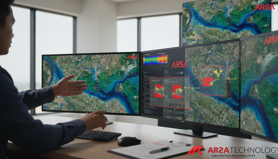
To address the critical gap between AI performance and trustworthiness, a novel framework called ADAGE (Alignment between Domain Knowledge And GeoAI Explanation Evaluation) has been introduced. This framework provides a systematic approach to evaluate how well the explanations generated by deep learning models align with established remote sensing domain knowledge, particularly concerning the distinct spectral properties of the Earth’s surface. This allows experts to verify if the AI is "thinking" correctly.
The ADAGE framework employs a specialized technique called Channel-Group SHAP (SHapley Additive exPlanations). SHAP is a method rooted in game theory that helps attribute the contribution of each input feature to a model's prediction. Channel-Group SHAP extends this concept by grouping related input channels – for example, all the infrared bands or all the radar polarizations – to estimate their collective contribution to pixel-level predictions. This approach aligns the AI's explanation level with how human experts typically analyze satellite imagery, making the explanations more intuitive and interpretable. By making these complex systems transparent, solutions like those offered by ARSA Technology in AI Video Analytics can be deployed with greater confidence in diverse mission-critical scenarios.
Practical Application: Satellite-Based Flood Mapping Case Studies
The ADAGE framework has been validated through experiments on two real-world satellite-based flood mapping scenarios. The first case study involved mapping post-flood water extent using a combination of Synthetic Aperture Radar (SAR) and Multispectral Imaging (MSI) data, especially under challenging cloudy conditions. SAR data is invaluable because its microwave signals can penetrate cloud cover and operate day or night, providing crucial insights when optical sensors are obscured. Open water typically shows low backscatter in SAR, as radar signals reflect away from the sensor. However, distinguishing open water from other flat, smooth surfaces (like tarmac) can be tricky (Lee & Li, 2026).
The second case study focused on detecting open and flooded urban areas using pre-flood and post-flood SAR data. In urban environments, floods can present unique challenges. Strong "double-bounce" interactions between partially submerged building facades and the water surface can significantly increase SAR backscatter, a complex phenomenon that traditional water detection methods might miss. These case studies demonstrated that ADAGE could quantitatively assess the alignment between AI model explanations and reference explanations derived from established remote sensing knowledge, such as the known spectral signatures of water across different bands. The framework proved capable of helping domain experts identify explanations that didn't align, whether due to novel patterns discovered by the AI or spurious correlations. This systematic approach enhances the credibility of AI models, making them more suitable for operational deployment in critical infrastructure management, a principle also integral to ARSA's AI Box Series for edge-based intelligence.
Enhancing AI Trustworthiness for Operational Workflows
The significance of the ADAGE framework extends beyond academic research. For governments, enterprises, and public institutions relying on GeoAI for Earth observation, the ability to trust AI models is paramount. The framework helps domain experts by providing a systematic way to scrutinize AI decisions, ensuring that models are learning robust, scientifically sound patterns rather than fragile, data-specific shortcuts. This fosters greater confidence in AI-driven insights, paving the way for wider integration of deep learning models into critical scientific and operational workflows.
By bridging the gap between sophisticated AI performance and the need for explainability and domain knowledge alignment, this research contributes to a future where AI systems are not just powerful but also transparent and trustworthy. This is essential for fields like disaster management, climate monitoring, and urban planning, where the consequences of erroneous predictions can be severe. ARSA Technology has been experienced since 2018 in developing and deploying practical AI solutions designed with these considerations in mind.
To explore how explainable AI and advanced IoT solutions can transform your operations and to gain a deeper understanding of ARSA Technology's commitment to building transparent and trustworthy systems, we invite you to contact ARSA for a free consultation.
Source: Lee, H., & Li, W. (2026). Evaluating the Alignment Between GeoAI Explanations and Domain Knowledge in Satellite-Based Flood Mapping. arXiv preprint arXiv:2604.26051. https://arxiv.org/abs/2604.26051