AI for Flood Resilience: Enhancing Detection with Topology-Informed Neural Networks
Discover how topology-informed neural networks combine satellite data for highly accurate, interpretable flood detection, enhancing disaster response and mitigation strategies.

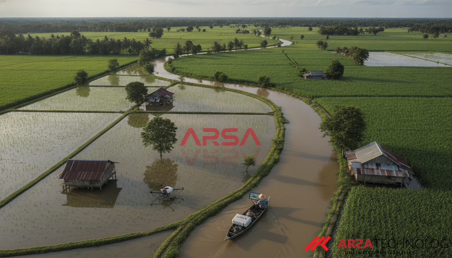
Flooding remains one of the most frequent and devastating natural disasters globally, causing significant human and economic loss. Rapid and accurate detection is paramount for effective emergency response and proactive mitigation. While advances in artificial intelligence (AI) and the increasing availability of satellite data have greatly improved environmental monitoring, challenges persist, particularly with optical satellite imagery obscured by cloud cover during critical flood events. New research introduces a powerful approach: Topology-Informed Neural Networks, which combine the strengths of various AI models with a novel mathematical framework to deliver more robust and interpretable flood detection.
Overcoming Observational Challenges with Hybrid Satellite Data
Traditional optical satellite images, while intuitive for human interpretation, are often rendered useless by clouds, a common occurrence during severe weather events that cause floods. To counteract this, Synthetic Aperture Radar (SAR) systems, such as those on Sentinel-1 satellites, offer a critical advantage: they can penetrate clouds, smoke, and operate day or night. However, SAR imagery inherently contains "speckle" – a form of noise that can make direct interpretation challenging for AI models. The optimal solution lies in a hybrid approach, leveraging both optical (e.g., Sentinel-2) and SAR data to overcome the limitations of individual sensors.
A significant hurdle in developing reliable flood detection models has been the lack of standardized, publicly available datasets. This was addressed with the introduction of the SEN12-FLOOD dataset, a comprehensive collection of co-registered time-series data from both Sentinel-1 SAR and Sentinel-2 multispectral optical imagery. This dataset captures locations affected by floods in Africa, Iran, and Australia, encompassing both rural and urban areas, highlighting the diverse impacts of flooding on communities with varying infrastructure and resources. Crucially, each image in these sequences is labeled with a binary flood status, enabling AI models to learn to identify flood events by analyzing changes over time. ARSA Technology, for instance, offers custom AI solutions that can integrate and process such diverse satellite data streams for specialized environmental monitoring tasks.
The Power of Temporal Analysis and Neural Networks
Early AI approaches for flood detection often focused on analyzing single satellite images. However, a river widening significantly in sequential images, or new water bodies appearing over time, provides undeniable evidence of flooding – information that a static, single-image analysis cannot reliably capture. This highlights the indispensable role of temporal information in accurate flood detection.
Researchers have explored various neural network architectures for this task. Convolutional Neural Networks (CNNs), like ResNet-50, are adept at extracting local visual patterns such as edges and textures from individual images. When these features are fed into a Gated Recurrent Unit (GRU) network, a type of recurrent neural network designed to process sequences, the model gains the ability to learn from changes over time. This temporal analysis has been shown to substantially improve accuracy compared to single-image methods. More advanced models, such as Vision Transformers (ViTs), have also demonstrated strong performance, yet many of these deep learning models often operate as "black boxes," making their decision-making processes opaque. In safety-critical applications like remote sensing for disaster management, understanding why a model makes a certain prediction is crucial for trust and effective deployment.
Topology-Informed Neural Networks: Adding Interpretability and Robustness
To enhance both the robustness and interpretability of flood detection systems, new research from the US Naval Research Laboratory and Stanford University introduces Topology-Informed Neural Networks. This novel approach integrates Topological Data Analysis (TDA), a mathematically grounded framework, into existing neural network architectures.
TDA provides a unique way to understand the fundamental "shape" of data, capturing global structural features that remain unchanged even when the data is stretched, bent, or slightly perturbed. For imagery, especially those with geometrically interpretable structures like water bodies, TDA is particularly powerful. Its main tool, persistent homology, tracks the "birth" and "death" of topological features such as connected components (representing distinct water bodies) and "holes" (e.g., land parcels encircled by water). Features that persist across a wide range of analytical thresholds are considered more significant and less likely to be noise, offering a stable "mathematical fingerprint" of the image.
By extracting these topological features from each satellite image and incorporating them into neural networks, the research demonstrates several key findings:
- Independent Flood Signals: Topological descriptors alone carry meaningful flood signals, proving their intrinsic value.
- Complementary Strengths: When combined with features extracted by CNNs (which excel at local textures), topological features provide a global structural context, leading to more comprehensive understanding. This fusion results in highly robust and interpretable flood detection systems.
- Enhanced Accuracy: The combined approach achieved a 98.9% accuracy, a significant improvement over the 95.7% baseline reported for convolutional recurrent approaches on dual-modality data. This performance extends to other critical metrics like precision, recall, and F1 score, which are vital in safety-critical applications where missing a flood can be more detrimental than a false alarm.
This blend of local (CNN-derived) and global (TDA-derived) information, processed over time by networks like GRUs, enables a more nuanced and reliable understanding of flood dynamics from satellite imagery.
Practical Applications and Business Impact
For enterprises and government agencies involved in disaster management, urban planning, and infrastructure, the implications of topology-informed neural networks are substantial:
- Faster, More Reliable Emergency Response: The ability to rapidly detect floods with high accuracy and interpretability allows emergency services to allocate resources more effectively, identify affected areas, and coordinate rescue efforts with greater precision. This minimizes response times and mitigates human suffering and economic disruption.
- Proactive Risk Management: Enhanced flood detection capabilities support better predictive modeling and risk assessments. This allows urban planners and infrastructure operators to identify vulnerable areas, design resilient infrastructure, and implement early warning systems to protect assets and populations.
- Improved Infrastructure Monitoring: For industries operating critical infrastructure across vast geographical areas, such as energy, transportation, and logistics, real-time flood monitoring provides vital intelligence for operational continuity and damage assessment. This approach also aligns with requirements for data sovereignty and on-premise processing, as demonstrated by the ability of these models to operate without constant cloud dependency. Solutions like ARSA Technology's AI Video Analytics Software or the AI Box Series are designed for on-premise deployment, offering full data ownership and control.
- Enhanced Compliance and Accountability: In safety-critical domains, transparent AI models that can explain their reasoning are invaluable. Topology-informed methods offer human-understandable features, crucial for auditability and demonstrating compliance with regulatory standards for disaster preparedness and environmental monitoring. This supports organizations in meeting their obligations and building public trust. ARSA has been building AI since 2018 for various industries we serve, including public safety and defense, where transparency and reliability are non-negotiable.
This research underscores that while larger neural networks are one path to improvement, a deeper mathematical understanding of the phenomena being observed can guide AI to "see differently" and capture the most relevant information – in the case of floods, the critical changes in shape and connectivity of water bodies.
Sources
Li, S., Zhao, M., Raj, R.G., and Chen, T. (2026). Topology-Informed Neural Networks for Flood Detection in Optical and Synthetic Aperture Radar Imagery. arXiv preprint arXiv:2606.26204*.
- Zhao, M. (2026). Topology-Informed Flood Detection from Satellite Images.
Unlock the full potential of your operational intelligence with advanced AI and IoT solutions. Explore ARSA Technology’s comprehensive range of AI video analytics, face recognition, and custom AI development services, engineered for precision and reliability in critical environments. Contact ARSA today to discuss your organization's unique needs.